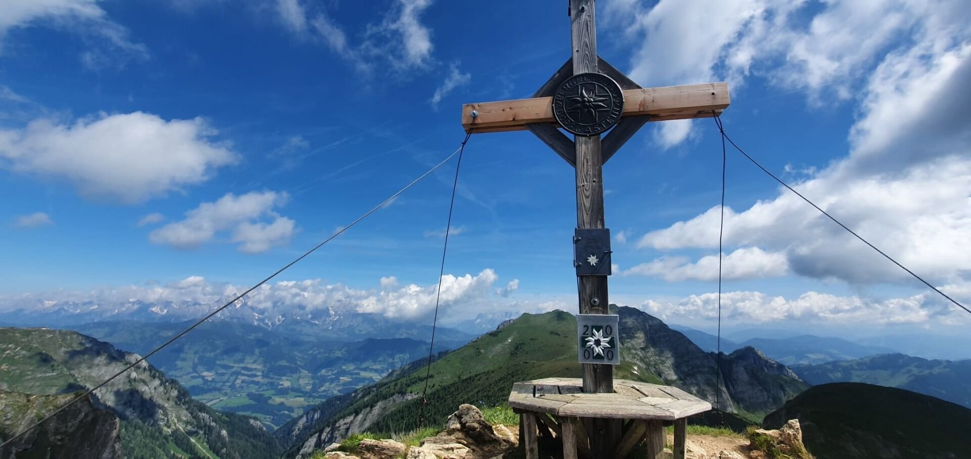
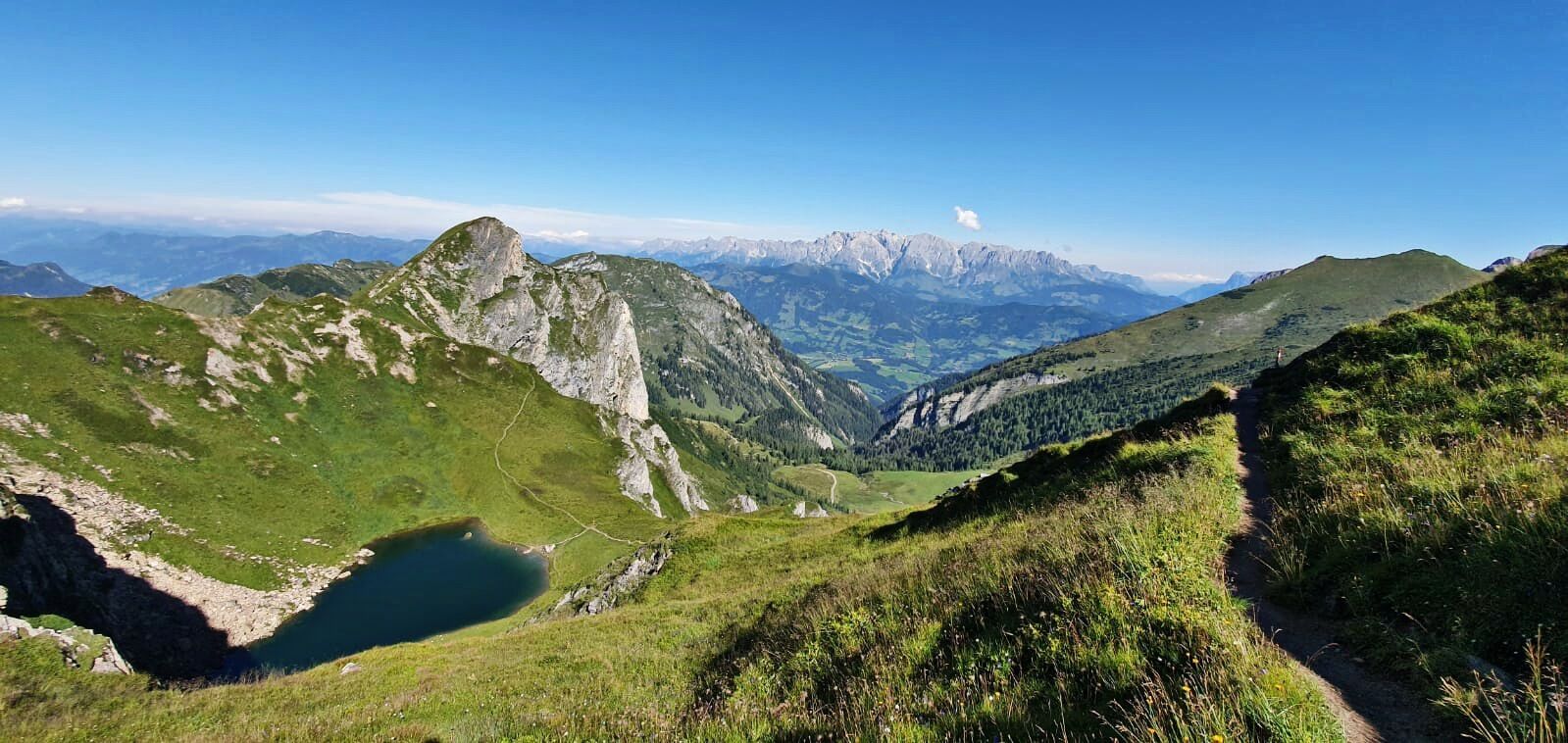
The pointed summit of the Schuhflicker is a distinctive feature of the of the eastern flank of Dorfgastein. Beginning at the mountain station of the Gipfelbahn - Fulseck, you will hike along the Biotope Trail, past a number of ponds to the Arltörl, one of the most ancient valley crossings into Gasteinertal. In a series of serpentines, the trail leads you from plateau to plateau, and ultimately to the summit cross. The name "Schuhflicker" derives from an old legend, which says that a cobbler was punished for his bladphemous words by being turned into stone. Your hike down will take you via the Schuhflicker See to the Urkübl, and past the Paarseen lakes to the Gasteiner Höhe. A forest trail will lead you across the Steiner Hochalm (staffed) and back to the hike starting place Hauserbauer.
Tickets Yoga Dagen
-
Regio
-
Ervaringen
-
Vitaliteit
-
Evenementen
-
Service